
GPS Accuracy in mobile devices
GPS measurement
Area measurement presents a significant challenge for Conservation Agriculture projects. Demonstration plots are typically small at a third of a Ha or less and producer plots are often as small and typically irregular in shape.
However, the belief that most have in GPS providing the most accurate results is often misplaced. Higher accuracy GPS is will give better than 3.5 meters horizontal accuracy. Meaning your GPS recorded position can be anything up to this distance from where you are stood. Errors such as these may seem small but when they are accumulated, as they are over the many readings necessary to measure an area, the error can be very significant, particularly on small land holdings.
For this reason it is important to have an understanding of the limitations and accuracy GPS on mobile devices.
GPS on mobile devices
Mobile devices use what is known as 'Assisted' GPS or A-GPS. Assisted because the GPS signal is found from both a GPS satellite and the cell or wireless network the mobile device is running on.
Theoretically this 'assist' improves the speed of finding a GPS signal but in reality it also improves the accuracy. Experience shows that using mobile devices over a poor or inconsistent cell network can seriously effect GPS accuracy to the point where this approach can no longer be considered practical.
In the illustrations we can look at two mapping exercises using extensionWorker. The first using satellite imagery shows a clean perimeter and an accurate area measurement. In the second we can see a 'drifting' perimeter and a significantly erroneous area measurement.
Summary
- On mobile or other platforms mapping with satellite imagery remains more accurate than GPS.
- Even the very best GPS units often only offer better than 3.5m horizontal accuracy.
- Mobile devices can offer a viable alternative to specialized GPS.
- However, the accuracy of this option will be dependent on the quality of you cell network.
- If you are looking for a mobile solution choose an application one that offers both satellite and GPS mapping.
Resources
Android GPS Settings

As with most mobile platforms Android gives the user the choice between GPS and High Accuracy GPS. High Accuracy GPS might not be all it seems.
Satellite Mapping
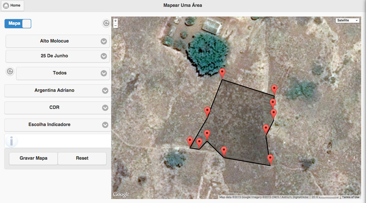
With extensionWorker's satellite imagery function we can get a much cleaner perimeter line and hence a much better area measurement.
GPS Mapping showing 'Drift'
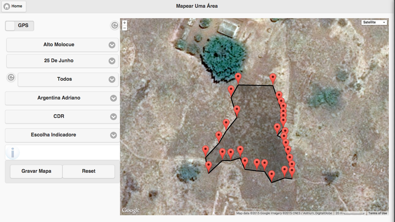
As the extensionist walks the perimeter to measure the area we can see that if the cell network drops the GPS position 'drifts' significantly both inside and outside the perimeter giving rise to quite significant errors.